Wooden Map of the United States
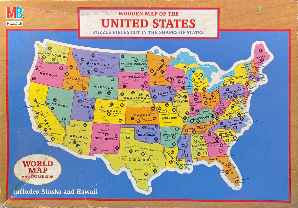
The central focus is a stylized, colourful map of the contiguous United States, set against a solid blue background. The entire map is contained within a thin red rectangular border, while the outer area resembles a light wood grain texture. At the top, a prominent white rectangular header features the bold, red-lettered title "WOODEN MAP OF THE UNITED STATES," with the subtitle "PUZZLE PIECES CUT IN THE SHAPES OF STATES" below.
Each individual state is filled with a distinct, flat pastel colour—including shades of yellow, pink, green, and light purple—to create a clear visual separation between neighbors. The map is detailed with black typography labeling state names and major cities, alongside thin black lines indicating rivers. Throughout the states, various small black pictorial icons are dispersed, representing local industries, agricultural products, natural landmarks, or recreational activities, such as pine trees, factories, or symbols representing local wildlife.
To the lower left, an oval-shaped callout with a cream-coloured background informs the viewer, "WORLD MAP ON REVERSE SIDE." Below the map itself, the text "Includes Alaska and Hawaii" is printed in simple white font. The overall aesthetic is that of a vintage, educational children's illustration, relying on high-contrast primary and secondary colours to emphasize geography and regional characteristics.


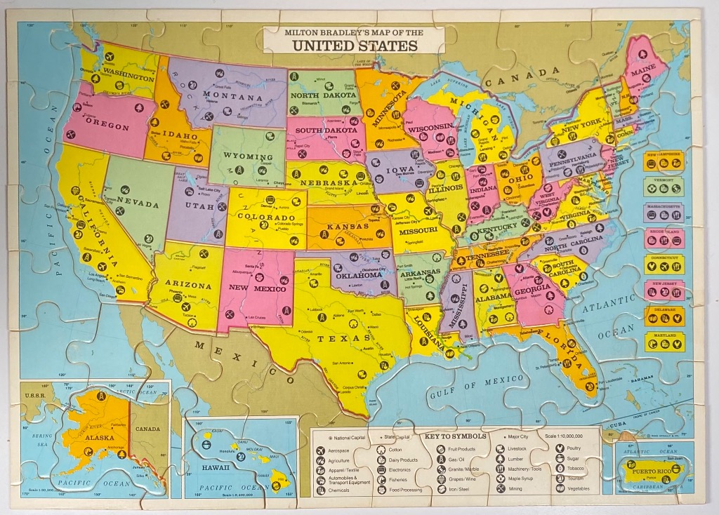
This vintage-style illustrated map of the United States depicts the country divided into colorful segments representing each state. The map is primarily yellow, green, pink, and purple, with light blue representing the surrounding oceans, the Gulf of Mexico, and the Great Lakes. A prominent title banner at the top reads, "Milton Bradley's Map of the United States," and the overall aesthetic is reminiscent of mid-20th-century educational wall charts.
Each state is labeled with its name and marked with small, circular icons that denote local industries or geographical features, such as agriculture, mining, and manufacturing. A comprehensive "Key to Symbols" is located in the lower-right corner, explaining these icons, which range from aerospace and cotton to tourism and fisheries. The geography includes national capitals, state capitals, and major cities marked with small dots.
In the bottom-left corner, a separate inset shows Alaska, while a smaller inset for Hawaii is positioned toward the bottom center. A final inset for Puerto Rico appears in the lower-right corner. The borders of Canada and Mexico are visible, and the map features longitudinal and latitudinal grid lines, giving it a technical, cartographic appearance consistent with classic schoolroom geography tools.
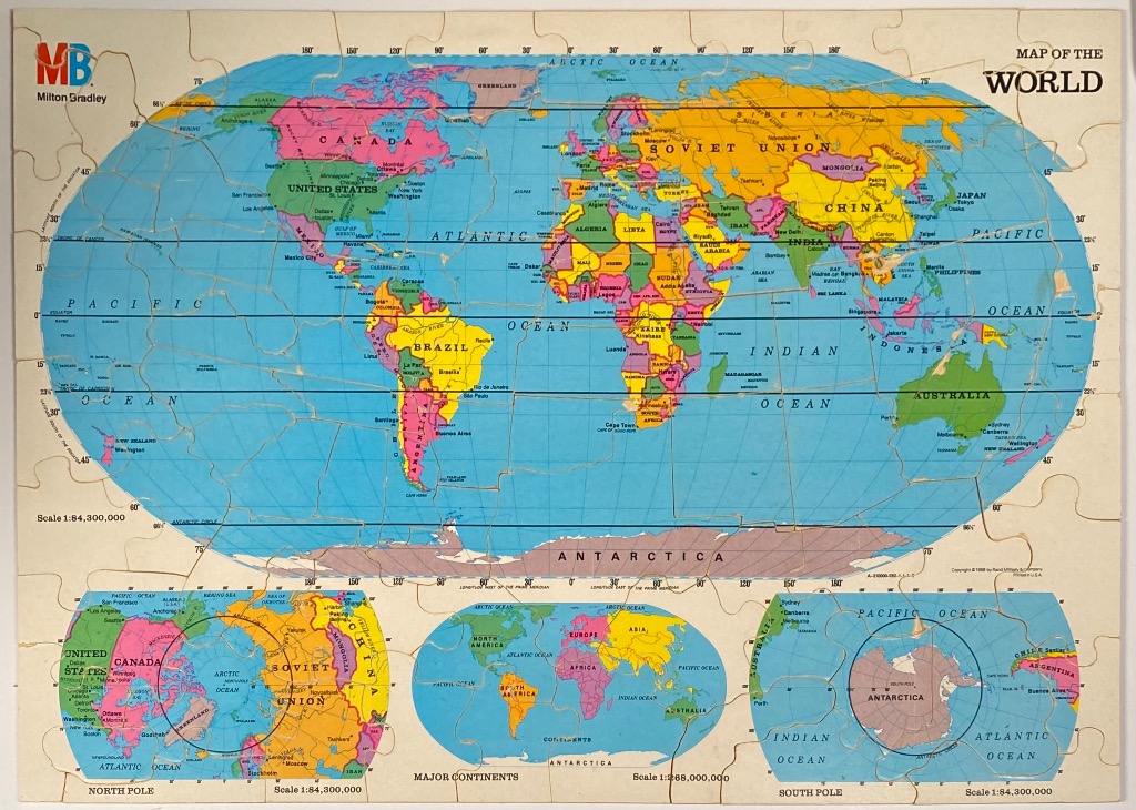
This vintage-style educational map features a large central elliptical projection of the world, bordered by cream-coloured margins containing cartographic data. The central map illustrates political boundaries of the late 20th century, notably featuring the Soviet Union. Major landmasses are rendered in distinct pastel shades of pink, yellow, green, and orange to differentiate sovereign states, while the vast oceans are depicted in a uniform, flat blue.
The layout includes three additional inset maps along the bottom edge to provide varied perspectives of the globe. On the left is a polar projection centered on the North Pole, on the right is a polar projection centered on the South Pole, and in the center is a smaller, oval-shaped world map illustrating the major continents. Each inset is surrounded by clear labeling for regional oceans and geographical features.
The overall aesthetic is that of a classroom or reference atlas from the era. The color palette relies on high-contrast primary and secondary tones for the continents against the muted blue background of the seas. Fine black text identifies nations, major cities, and oceans, while thin black lines indicate latitude and longitude coordinates. The composition is structured and academic, focusing on geographical clarity and the political climate of the period.

