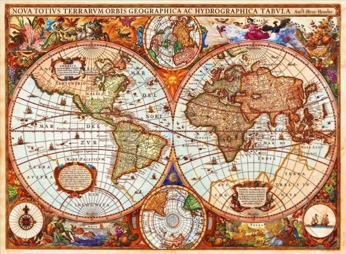
This highly detailed 17th-century style world map is centered on two large, circular hemispheres representing the globe. The western hemisphere features North and South America, while the eastern hemisphere displays Europe, Africa, and Asia. Both spheres are rendered with antiquated geographical knowledge and labeled in Latin. Smaller circular maps are positioned at the top and bottom center, showing the North and South polar regions, and a compass rose is featured in the lower-left corner.
The layout is densely packed with elaborate, hand-colored illustrations in the margins. Figures depicting classical deities, symbolic representations of the elements, and lush arrangements of fruit and foliage frame the maps. Ships are scattered across the vast oceans depicted within the spheres, adding a sense of maritime exploration. The overall composition is symmetrical and academic, balancing the scientific nature of the cartography with the ornate, decorative style of the period.
The color palette is warm and aged, utilizing sepia tones, ochre, muted greens, and soft reds to mimic the appearance of weathered parchment and ink. The lighting is flat, highlighting the intricate linework and calligraphic text that fills the oceanic voids. The atmosphere is one of historical exploration and discovery, evoking the aesthetic of Renaissance-era cartography where maps were treated as both navigational tools and works of art.