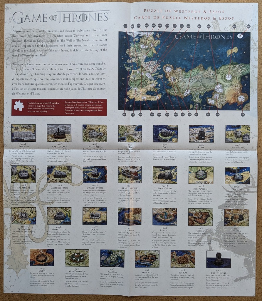
This instructional guide displays a detailed map of a fictional fantasy world, spanning two large continents. The upper portion serves as the focal point, featuring an intricate map where various locations are marked with numbered circular tags. Thin red lines connect these numbers to their corresponding geographical positions, creating a technical and navigational appearance against a parchment-like background. The overall layout is structured and informative, designed to assist in locating specific landmarks.
Below the main map, the document presents a comprehensive grid of smaller, individual illustrations. These depict various fortresses, cities, and iconic structures, each accompanied by a numerical reference, a title, and descriptive text. The illustrations are rendered in a miniature, detailed style, showing stone castles, walled cities, and ruins set against lush, textured landscapes. The color palette relies heavily on earth tones, deep blues for the surrounding seas, and muted greens, reflecting a grounded, historical, and slightly weathered aesthetic.
The document is characterized by its organized, grid-like composition, reminiscent of a historical catalog or an educational atlas. The typography is clean and professional, balancing the dense imagery with clear labels. The background has a subtle, light-colored, aged paper texture, which enhances the fantasy cartography theme. The presentation is functional, blending illustrative fantasy art with the technical clarity of a reference manual.