World Map 1665

This illustration features a classic 17th-century style world map, arranged within two large circular hemispheres. The Western Hemisphere on the left depicts the Americas, while the Eastern Hemisphere on the right showcases Europe, Africa, and Asia. Both globes are filled with archaic geographical details, including stylized coastlines and inland features representative of historical cartography.
The map is surrounded by a dense decorative border and external imagery. Above the two hemispheres is a horizontal frieze featuring ten individual portraits of figures on horseback, flanking a central circular portrait of a man in formal attire. The corners and margins around the spheres are intricately decorated with baroque-style flourishes, including small sailing ships on the oceans, compass roses, and ornate cartouches containing calligraphic Latin text.
The color palette is muted and aged, utilizing earthy tones of sepia, faded gold, ochre, and deep crimson. These colors create a weathered, antique parchment appearance, mimicking the aesthetic of a genuine historical artifact. The composition is balanced and symmetrical, emphasizing the classical scholarly nature of the map. The style is that of a hand-engraved copperplate map from the era of exploration, filled with elaborate artistic embellishments that blend scientific record with the ornate decorative traditions of the period.
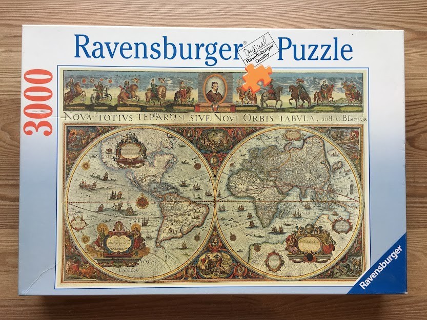
This artwork depicts a detailed seventeenth-century double-hemisphere world map, presented in a classical cartographic style. The composition is divided into two circular hemispheres—the Americas to the left and Europe, Africa, and Asia to the right—set against a parchment-toned background covered in intricate geographical lines. The oceans are populated with tiny illustrations of sailing ships and sea monsters, while the landmasses feature delicate topography and historic nomenclature.
The map is surrounded by highly ornate, colorful borders and decorative vignettes. Above the primary map, a frieze displays a series of historical figures on horseback, flanking a central portrait of a cartographer in an oval frame. In the corners surrounding the hemispheres, elaborate allegorical illustrations incorporate human figures, celestial motifs, and ornate cartouches containing text. The artistic style is reminiscent of copperplate engravings common in historical atlases.
The color palette consists of muted, earthy tones, including ochre, sepia, faded greens, and soft blues, which evoke the feel of aged paper. The linework is extremely fine, characteristic of classical etching or map-making techniques from the 1600s. The title "NOVA TOTIVS TERRARVM SIVE NOVI ORBIS TABVLA" is prominently inscribed in a classic serif font across the horizontal strip separating the upper frieze from the main map, lending a scholarly, antique atmosphere to the entire scene.
by Stitchpuzz 2024-01-06
