The Best of Connecticut

The central focus is a yellow map of Connecticut surrounded by a busy collage of historical, cultural, and natural landmarks of the state. The word "CONNECTICUT" is featured prominently in a red banner across the top center, flanked by illustrations of a deer and various natural motifs. The map itself is detailed with roads, city names, and small vignettes of local activities like cycling, train travel, and boating.
Surrounding the central map is a border of rectangular panels, each highlighting a specific town, museum, or historic house. These smaller illustrations depict iconic locations such as the Mystic Seaport, lighthouses, university halls, and various statues. Scattered throughout the collage are historical figures, local flora and fauna, and additional snippets of trivia text that fill the negative space.
The artwork uses a vibrant, painterly style that blends illustration and cartography. The color palette is warm and varied, dominated by the yellow of the map, earthy greens of the landscape, and bright accents in the individual vignettes. The light is bright and even, giving the entire image the appearance of a nostalgic travel poster or a commemorative folk-art print. The overall mood is educational, celebratory, and densely packed with visual interest.

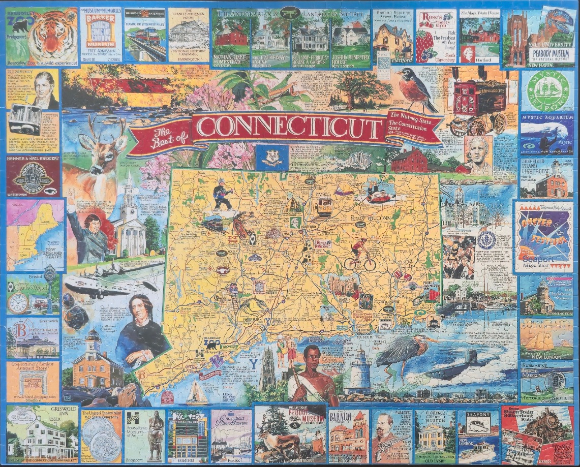
This illustrative map of Connecticut is the centerpiece of a larger collage, presented on a mustard-yellow background featuring major roads and key towns. The map is decorated with small vignettes of regional activities, such as cycling, boating, and hiking, while a prominent red banner across the top displays the title, "The Best of CONNECTICUT." The surrounding border is composed of numerous small, rectangular panels, each highlighting iconic landmarks, historical buildings, local industries, and cultural sites from across the state.
Surrounding the central map are various wildlife illustrations, including a tiger, a white-tailed deer, and a great blue heron. Historical figures such as Eli Whitney and Harriet Beecher Stowe are depicted in portrait style alongside sketches of buildings like lighthouses and historic homesteads. The composition is highly dense, filled with text snippets about state history, geography, and various "must-see" attractions. Smaller graphic elements, such as clocks, coins, and maps of New England, contribute to the scrapbook-like aesthetic.
The overall colour palette is warm and varied, dominated by the yellow of the central map, contrasted by deep blues, earthy greens, and vibrant reds in the border vignettes. The style is that of a folk-art-inspired montage, using clean line work and flat, saturated colours to create a nostalgic and informative guide to the state. The lighting is uniform across the entire scene, giving the impression of an informative poster or a historical tourist map.
