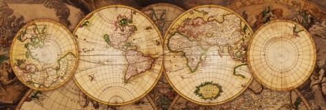
This illustration depicts an antique-style world map presented through four distinct circular projections arranged in a horizontal row. The two central circles are the largest, displaying the Americas to the left and Europe, Africa, and Asia to the right. Flanking these are two smaller circular grids, one representing the Arctic and the other potentially a blank or stylized southern projection. The entire composition is layered over a backdrop of faded, ornate cartographic drawings, suggesting a complex, multi-layered historical document.
The color palette is dominated by warm, muted tones, including shades of sepia, parchment yellow, and faded earth tones, giving the image a sense of age and discovery. Thin black lines map out the longitude and latitude coordinates across each circular segment, while the landmasses are rendered with fine, hand-drawn detail typical of early navigational charts. The lighting is soft and consistent across the surface, emphasizing the textured, aged appearance of the paper.
Intricate decorative elements fill the negative space around the spheres, featuring flourishes and cartographic ornaments that evoke the aesthetic of 17th or 18th-century atlas illustrations. The arrangement is symmetrical, creating a balanced and formal composition that feels scholarly and exploratory. The overall mood is one of nostalgic adventure and historical craftsmanship, highlighting a period when the world was being defined through art and mathematics.