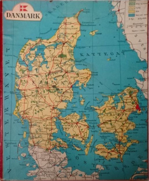
This illustration features a vintage cartographic map of Denmark. The landmass is depicted in muted beige and light green tones, showcasing its unique geography consisting of the Jutland peninsula and numerous islands, including Funen and Zealand. The surrounding sea, including the Kattegat and parts of the North Sea and Baltic Sea, is rendered in a deep, flat teal blue. The composition is oriented vertically, with grid lines subtly overlaying the entire scene to provide spatial structure.
Fine red lines crisscross the landmass, representing a network of roads that connect various cities and towns, which are marked with small black dots and labeled in a vintage serif typeface. The map includes several text labels for major regions and bodies of water, such as "Jylland," "Kattegat," and "Vesterhavet." In the upper left corner, there is a shield-shaped emblem featuring a Danish flag and the word "DANMARK." An inset key in the upper right provides a legend for elevation and map markings, adding to the authentic feel of a schoolroom or atlas-style topographical chart.