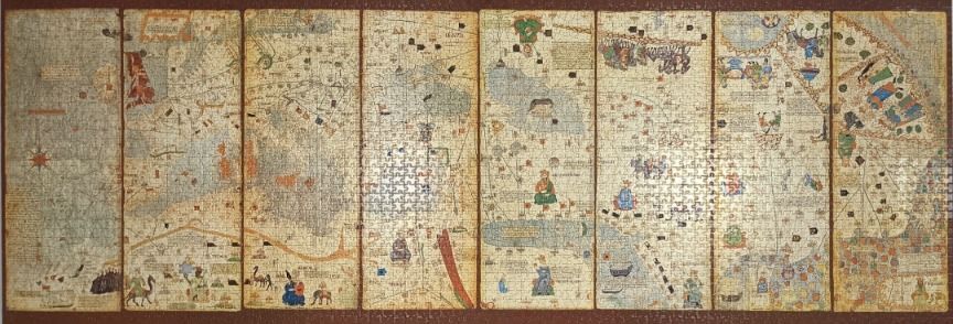
This image displays a panoramic reproduction of the Catalan Atlas, a masterpiece of medieval cartography. The map is presented in a horizontal, multi-panel format, showcasing a world view as understood in the 14th century. The composition is dense with geographical markers, including coastlines, mountain ranges, and numerous small illustrations of rulers, merchants, and animals distributed across the landscape.
The aesthetic is that of an aged parchment, characterized by a warm, weathered yellow-beige background that mimics the texture of centuries-old vellum. The cartography uses delicate black ink for labels, topographical lines, and navigational rhumb lines. Accent colours are muted yet distinct, featuring highlights in crimson, royal blue, deep green, and occasional touches of gold leaf, which bring the miniature illustrations to life against the sandy tones of the map.
Throughout the map, small pictorial vignettes provide snapshots of cultural and political life, depicting seated monarchs on thrones, camels traversing desert regions, ships sailing the Mediterranean, and various mythical or exotic figures. The overall layout is structured by vertical dividers, creating a rhythmic sequence that guides the eye from the western edges of the known world across to the eastern territories, blending geographical data with artistic imagination and historical storytelling.