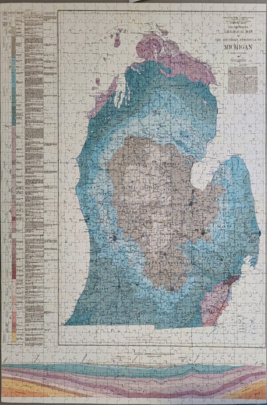
This image depicts a detailed, vintage-style geological map of the southern peninsula of Michigan. The central focus is the landmass itself, illustrated with various shades of blue, brown, and pink to signify different geological formations and rock layers. The peninsula is oriented vertically, surrounded by a faint outline of the surrounding Great Lakes, with fine text labeling counties and geological features throughout the interior.
Along the left-hand margin, a vertical legend provides a comprehensive key, using a column of colour-coded blocks to correspond with the different rock ages shown on the map. In the upper right corner, a title block reads "Geological Map of the Southern Peninsula of Michigan" along with various administrative and cartographic credits.
At the bottom of the map, a separate horizontal cross-section diagram shows an idealized view of the subterranean rock layers. These layers mimic the colour palette of the map above, creating a cohesive visual representation of the region's complex stratigraphy. The overall aesthetic is that of a historical scientific document, using muted, earthy, and washed-out blue tones typical of late 19th or early 20th-century print cartography. The background is a pale, off-white parchment colour, emphasizing the clean, technical lines of the map's grids and labels.